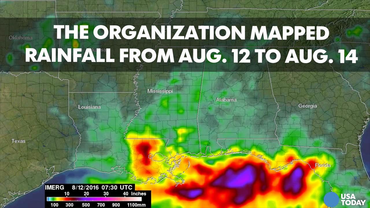
NASA graphic shows devastating rainfall in Louisiana
Show Caption
Hide Caption
NASA graphics show deadly Louisiana flood
NASA graphics mapped out the flooding that hit the Gulf Coast last week.
Paste BN
Rising waters from intense rainfall in Louisiana resulted in the evacuation of thousands of people and 13 deaths in the state.
NASA’s Earth Observatory blog used satellite-based measurements from Aug. 12 to 14 to map the rainfall as it fell across the southern United States.
The images show how quickly the rainfall accumulated over the state by measuring rainfall totals for every three hours.
Some 40,000 homes have been affected by the flooding which hit Baton Rouge and Lafayette areas.
Parts of southern Louisiana and Mississippi were hammered by up to 25 inches of rain late last week. The sun re-emerged Monday, but the water was everywhere. And the threat of showers remained.
Follow @MaryBowerman on Twitter.