Hughes Fire sets thousands of acres ablaze prompting more evacuations: See map
The Hughes Fire in Southern California set thousands of acres ablaze and prompted numerous evacuations as firefighters worked to contain the flames.
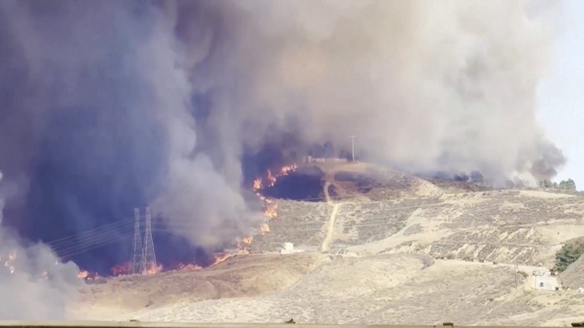
Over a week after thousands of homes were lost to the Palisades and Eaton Fires, another spread across Ventura and Los Angeles and forced tens of thousands to flee, according to Cal Fire.
The bushfire, which spawned near Castaic Lake northwest of Downtown Los Angeles, was discovered on Wednesday morning, according to Cal Fire.
The Hughes fire spans from Los Angeles County to Ventura and has consumed 10,176 acres with 14% containment.
The fire comes as Los Angeles and Ventura Counties remain under a red flag warning due to "Critical Fire Conditions," according to the National Weather Service, NWS.
"Continue to avoid creating sparks, be aware of your surroundings and report any smoke to authorities," the NWS's LA office wrote on its website.
Parts of California were also under Air Quality, Wildfire Smoke, Windblown Dust and Ash Advisories through Thursday due to the Hughes Fire, according to the South Coast Air Quality Management District.
Evacuation orders for Hughes Fire
Evacuation orders were issued for the Lake Hughes Road area near Castaic Lake. You can find an interactive map of evacuation orders and warnings related to the Palisades Fire on the Cal Fire website.
Other wildfires in California
Fires recently started in parts of Los Angeles, Riverside, and San Diego counties, where red flag warnings remain in effect until Thursday night. The Santa Ana winds will bring gusts of up to 50 mph and isolated gusts of 75 mph for mountainous areas, according to the National Weather Service.
Multiple small brush fires erupted in San Diego County on Tuesday before fire crews quickly extinguished them. The 85-acre Lilac Fire was 90% contained as of Wednesday morning. Meanwhile, crews also minimized the nearby Friars and Pala fires and the Riverview and Clay fires in Riverside County.
Cal Fire is also tracking the following fires:
- Palisades Fire- Los Angeles County, 23,448 acres, 70% contained
- Eaton Fire- Los Angeles County, 14,021 acres, 95% contained
- Hughes Fire- Los Angeles and Ventura Counties, 10,176 acres, 14% contained
- Sepulveda Fire- Los Angeles County, 40 acres, 0% contained
- Clay Fire- Riverside County, 39 acres, 65% contained
See below for a map of the latest blaze that's concerning authorities.
California wildfires map
Julia is a trending reporter for Paste BN. You can connect with her on LinkedIn, follow her on X, formerly known as Twitter, Instagram and TikTok: @juliamariegz, or email her at jgomez@gannett.com