When will the water recede after record flooding in central US?
- Heavy rain in the central US has led to some of the worst flooding since Hurricane Helene.
- The flooding is expected to continue for weeks as water recedes and impacts major rivers.
- Some areas experienced over 15 inches of rain, equivalent to three months' worth in just a few days.
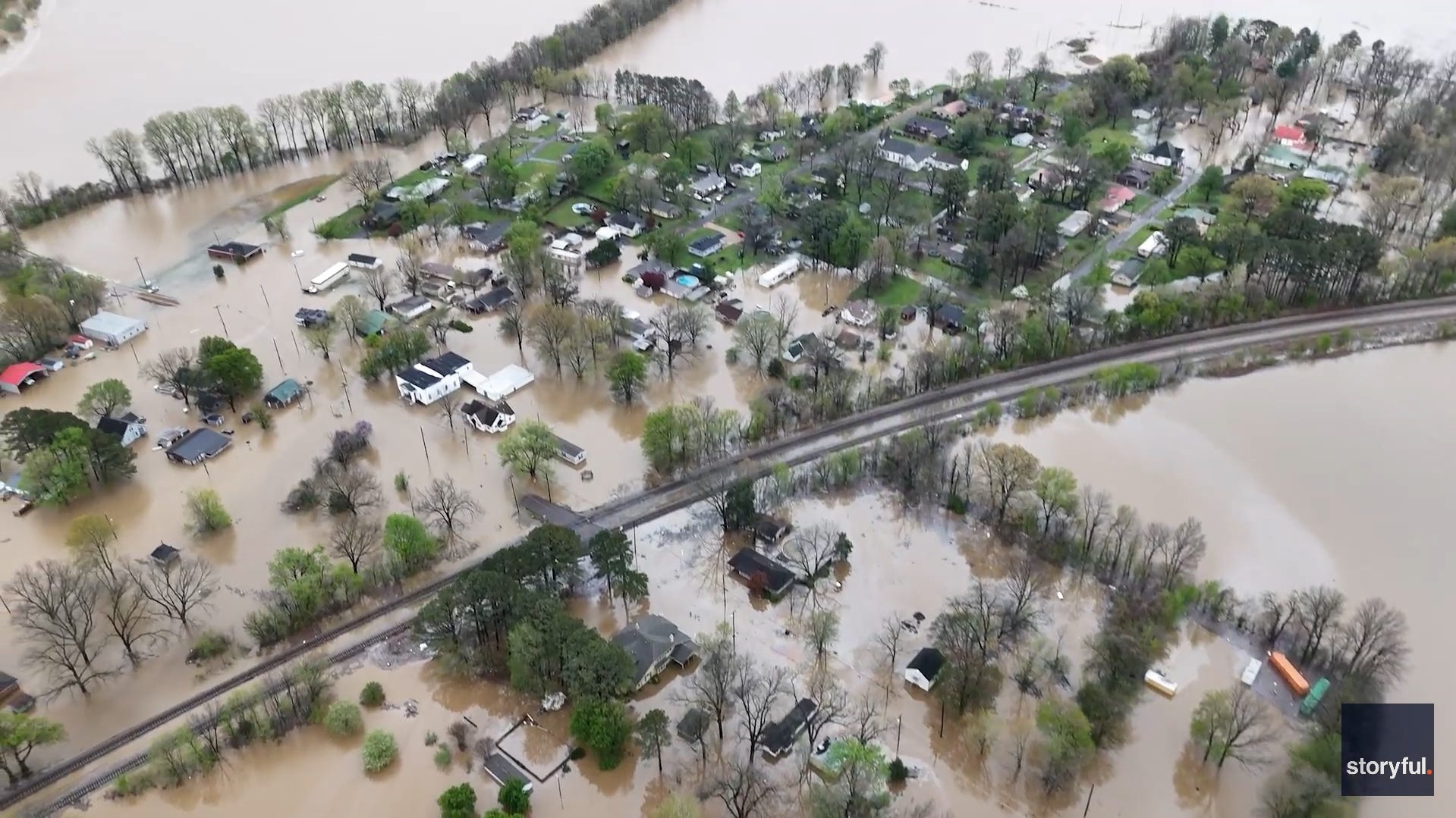
Some of the nation's worst flooding since Hurricane Helene last fall is continuing to unfold in the central U.S. this week, with potentially weeks to go before the deadly flooding finally ends in some places.
Although most of the heavy rain that's plagued the central U.S. over the past week has come to an end, the water that's already fallen will take days or even weeks to finally recede in many areas.
Indeed, even long after the rain ends, "all the water that gathered in urban areas and small streams will continue to flow and surge into progressively larger rivers in the region," noted AccuWeather senior meteorologist Alex Sosnowski in an online forecast.
On Monday, several dozen river gauges in several states were soon forecast to rise to "major" flood stage, the National Weather Service said.
Areas could be underwater for 'an extended period'
Floods on secondary rivers will be followed by flooding along the largest rivers in the region – the massive Ohio and lower Mississippi. "Some major roads and highways could be underwater for an extended period," Sosnowski said.
For example, the Ohio River at Cincinnati remains under a flood warning and is expected to crest at more than 60 feet on Monday before falling below flood stage sometime Friday morning, according to the weather service.
Because water takes many days and weeks to reach a crest then drop below flood stage, some areas along the Ohio and Mississippi Rivers could be underwater for a long period of time. This means that, in some cases, farmland could be inundated or too muddy to access well into the growing season, AccuWeather said.
In fact, it may take as much as two to three weeks for the water surge to cycle to the Mississippi Delta region, which eventually would include the New Orleans area. "The high and fast-moving water will negatively affect tug and barge operations on the Ohio and lower Mississippi rivers," Sosnowski predicted.
How much rain has fallen?
Several locations around the South measured over 10 inches of rain over the last few days, with some measuring more than 15 inches, Weather.com said. This included both Benton, Kentucky, and Hickory, Kentucky, according to NOAA.
Meteorologist Ben Noll said that in some parts of southern Indiana, Kentucky, western Tennessee, and central Arkansas, more than three Aprils' worth of rain fell just in the past few days.
And calling some of the totals "staggering," WKYT chief meteorologist Chris Bailey noted that "for areas with 11 inches or more, this is a 1 in 1,000-year rainfall event. That simply means it has a 0.1% chance of happening in a given year."
Was there record flooding?
The Kentucky River at Camp Nelson, south of Lexington, broke a record high on Sunday, hitting a level of 47.04 feet at the gauge, topping the record of 46.02 feet set in May 2010, the National Weather Service said. Records there date back to at least 1913.
The river also is set to near or top its record at the Frankfort Lock on Monday.
The Big Blue River in Shelbyville, Indiana, came within just a few inches of its record on Sunday, reaching a height of 19.98, just under the 20.2 record set in in March 1913.
Contributing: Dinah Voyles Pulver, Paste BN