Severe weather threat returns Tuesday for eastern, southeastern Iowa
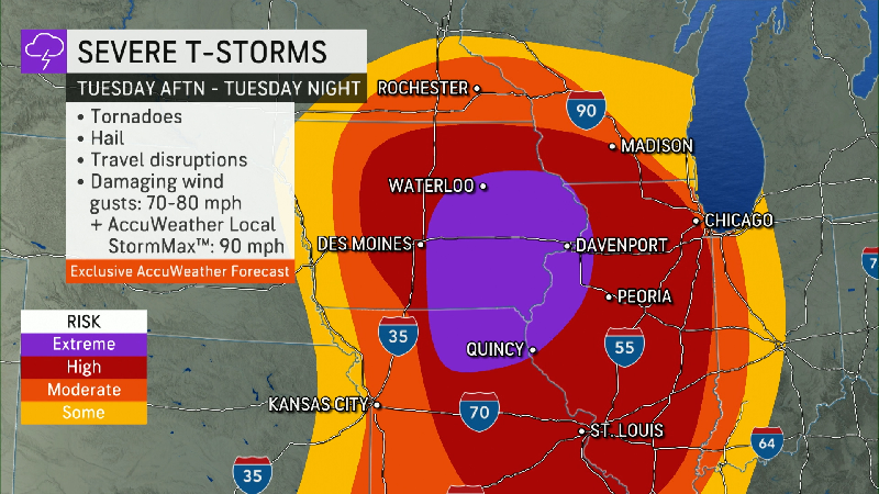
Parts of central and eastern Iowa are under the threat of severe storms Tuesday afternoon, according to the National Weather Service forecast.
The hazardous weather outlook predicts an enhanced to moderate risk in Des Moines for severe thunderstorms from Tuesday afternoon through the evening. Damaging winds, large hail and tornadoes are possible.
According to the NWS, the storm will move quickly across the state from east to northeast. Be prepared to take action quickly.
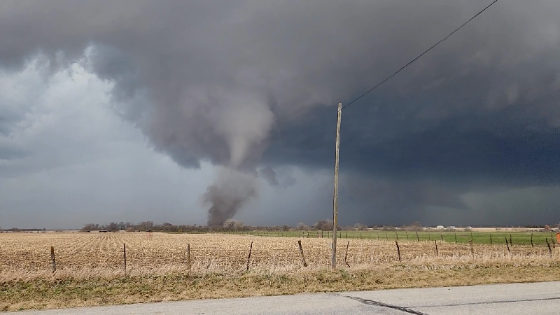
More: 9 possible tornadoes tallied in eastern Iowa Friday from 'strong and unusual storm system'
Tuesday will be rainy in Des Moines, with a chance of showers mostly between 1 p.m. to 4 p.m. then gradually becoming mostly sunny with a high of 79. Wind gusts may be as high as 47 mph overnight with a chance of showers and thunderstorms before 4 a.m.
Eastern Iowa areas hit by Friday's tornadoes may see severe storm conditions
Craig Cogil, a meteorologist at the NWS, said that the areas at highest risk in the state are the east, central and southeast portions of the state with a chance of large hail, damaging winds and a few tornadoes.
"The big thing is number one, have a plan of where to go and seek shelter beforehand," he said. "And then two, staying weather aware, make sure you know the forecast for your area, what to expect and then to have a way to receive any warning that may be issued."
Tornado safety: What to do when a watch or warning is issued depends on where you are
Noelle Alviz-Gransee is a breaking news reporter at the Des Moines Register. Follow her on Twitter @NoelleHannika or email her at NAlvizGransee@registermedia.com.