Michigan under tornado watch until 4 p.m.: Time frame meteorologists are monitoring
A tornado watch, a less severe alert than a tornado warning, has been issued for much of Michigan until 4 p.m. Wednesday by the National Weather Service, meaning that in addition to twisters, there’s a good chance for golf-ball sized hail and damaging winds.
As the day unfolded, meteorologists say, the risk is diminishing.
But, forecasters add, when even the warning ends, stay alert: There’s a second window for storms from 6-9 p.m.
"We've issued a tornado watch this is in effect until 4 p.m.," Alex Manion, a meteorologist with the National Weather Service in White Lake Township said at about 9 a.m. "We're especially watching from the 11 a.m. to 4 p.m. time frame."
US weather updates: 'Damage pretty widespread': Four deaths and injuries reported in Missouri tornado.
Flights delays, power outages
Along with the threat of a tornado comes the possibility of airport flight delays, power outages and flooding.
At Detroit Metro Airport, flights are facing gate holds and taxi delays, as well as airborne delays, of about 15 minutes or less, according to the Federal Aviation Administration, which is responsible for regulating all aspects of civil aviation.
Tornado watch vs. tornado warning: Here's the difference between the two alerts
DTE said that wind gusts up to 60 mph are possible, which can cause trees and branches to fall on our equipment resulting in power outages; but storm response teams are on standby, ready to "restore power as quickly and safely as possible."
Consumers Energy also pointed out the likelihood of severe weather on its website, noting that "thunderstorms are expected in your area which could cause tornados, downed wires, and outages" and its "outage center is the easiest way to report" a power problem.
Heavy rain from storms also could result in localized flooding, with warnings in parts of the state.
Better safe than sorry
Still, like with any weather prediction, it's possible there will be no tornadoes and only storms, with forecasters offering a more sophisticated version Wednesday of "better safe than sorry," explaining it is better to be prepared and cautious than to unnecessarily put yourself in harm's way.
It takes just minutes for a funnel cloud to touch down and destroy everything in its path.
Tornado watch vs. warning
A tornado watch, Manion said, means that the atmospheric conditions are ripe for severe weather, the tornado being the most destructive. After the watch, he added, a cold front is moving in, and "we're not 100% out of the clear" because "some weaker and brief tornados may be possible."
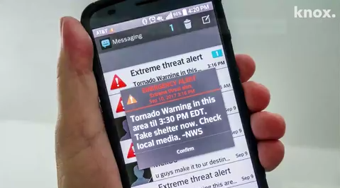
A tornado warning, he said, is issued when a tornado is spotted on radar or in real life, and that, he said, means you should seek shelter immediately because you are in imminent danger. When a warning is issued, TV and radio stations usually start to squawk and outdoor sirens often sound.
Tornadoes — rated on the Fujita Scale from 1 to 5, the most intense — can have wind gusts from 65 mph to more than 200 mph with a destructive force of a bomb, leveling homes, businesses, cars and anything in its path.
Contact Frank Witsil: 313-222-5022 or fwitsil@freepress.com.