Weird winter weather: Cold and snow to the East, but rain and warmth in the West
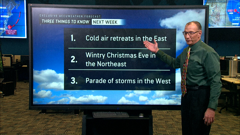
It's not looking like a white Christmas for much of the country. Regions most likely to get snow: the northern and eastern parts of the U.S.
What is in the forecast on Saturday, the first day of winter, is cold and rain – and warm temperatures for the West.
From the Great Lakes to the East Coast, a "seasonably strong and cold, high-pressure system" will bring below-average temperatures, with parts of the East forecast for "the coldest temperatures thus far this winter," the National Weather Service said.
Cold weather advisories forecast very cold wind chills – as cold as 12 below zero to 25 below zero – Saturday night to Sunday morning across central New York, northeast Pennsylvania, New Jersey, Massachusetts and Vermont.
Freeze watches and cold advisories extend to northern Florida and southeast Georgia.
The West: Rain and warm temperatures
Rain along the West Coast over Saturday and Sunday will douse northern California, the Pacific Northwest and the northern Intermountain West – and bring some snow at higher elevations, the weather service said. Northern California, southern Oregon and northwest Colorado are also under high wind warnings.
Prolonged moderate-to-heavy rainfall is forecast for northwest California into the middle of next week, the NWS said. Flooding is likely with the increased risk of mudslides, debris and rocks on roadways.
From 1 to 2 feet of rain is expected, especially along the western-facing mountain slopes through the week, according to AccuWeather. "One or more of the storms are likely to develop an atmospheric river that can funnel tremendous amounts of rain like a giant fire hose or snow like a massive snowmaking machine toward portions of the West Coast," senior meteorologist Brett Anderson said in an AccuWeather forecast.
Record-high temperatures could warm northern parts of the West – where temps get into the 40s and 50s – and the Southwest, where it will range from the 70s to 80s on Saturday and 60s to 70s on Sunday.
Let it snow in North and East US
Through Saturday evening, snowfall of 2 to 5 inches is expected to fall across northeast New Jersey, New York City, the Lower Hudson Valley, and parts of western Connecticut. Wind gusts of up to 35 mph could lead to blowing snow, making driving hazardous.
Snow is also forecast for New England, the northern Mid-Atlantic and parts of the Appalachians. The lake effect will help bring localized accumulations of 3-to-6 inches to parts of east central Ohio, southwest and western Pennsylvania, and northern West Virginia. Up to three inches of snow is forecast for western Maryland into Saturday night.The Great Lakes will get snow in addition to cold temperatures, thanks to the combination of lake-effect snow and a "cyclonic flow" of wind from the East coast. A developing low-pressure system is expected to bring more snowfall to the Upper Midwest and Great Lakes Sunday and, Monday, from North Dakota into Michigan.
Some of those areas have already been hit with significant snowfall – six to 11 inches had fallen in Michigan, North Dakota, Wisconsin and Minnesota by Friday morning, the weather service said. Forecasters urge people to take precautions in affected areas with the arrival of the arctic airmass. In Michigan alone, wind chill will range from 11 to -7 degrees.
Follow Mike Snider on X and Threads: @mikesnider & mikegsnider.
What's everyone talking about? Sign up for our trending newsletter to get the latest news of the day