Surge of cold air to bring below-freezing temperatures to Midwest Monday: See forecast
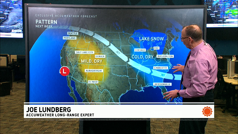
A cold front is moving through the Ohio Valley and will be followed by another surge of Arctic air that is expected to reach the Midwest Monday and move into the Mid-Atlantic and Northeast on Tuesday, according to the National Weather Service.
The cold front is expected to be accompanied by snow showers Monday across the Northeast with potential for isolated snow squalls that could result in hazardous travel due to "sudden reduced visibilities, gusty winds and quick minor accumulations of snow," the weather service said in its forecast Monday morning.
High temperatures are expected to be 10 to 20 degrees below average today from the Upper Midwest to lower portions of the Ohio Valley, and while the airmass is expected to lose some intensity as it reaches the East Coast, it will still be responsible for below average temperatures by Tuesday for the Eastern Seaboard, the NWS said.
According to AccuWeather, overnight temperatures in the teens and single digits are expected across parts of the Midwest, Ohio Valley and interior Northeast early this week, while lows in the Dakotas and parts of Wisconsin and Iowa will be subzero.
Lake effect snow expected near Great Lakes
The weather service said Monday heavy lake effect snow showers are expected to develop late Monday as the colder air moves across the Great Lakes, with localized snowfall accumulations of 1-2 feet for isolated locations, mainly east of Lakes Erie and Ontario.
"A storm currently sweeping through the Great Lakes region bringing a round of snow will also kick off another round of lake-effect snow downwind of the lakes over the upcoming days. Once again, the potential for feet of snow downwind of Lakes Huron, Erie and Ontario are possible between Monday and Wednesday night, likely leading to hazardous travel," said AccuWeather Meteorologist Brandon Buckingham Monday.
According to AccuWeather, some of the highest snow totals through midweek are expected across the Keweenaw Peninsula, the Porcupine Mountains and between Munsing, Michigan and Whitefish Point, Michigan, along the shores of Lake Superior.
Major cities expected to be impacted by the lake effect snow include Detroit, Cleveland, Pittsburgh and Buffalo, among others, according to AccuWeather.
Gabe Hauari is a national trending news reporter at Paste BN. You can follow him on X @GabeHauari or email him at Gdhauari@gannett.com.