Heavy rains, severe storms bring flash flood threat to Southeast states
Millions of Americans are at risk of flooding from excessive rainfall and stormy weather over the next few days across parts of the Southeast and Mid-Atlantic, forecasters said.
A front lingering in the Gulf Coast will bring thunderstorms and showers to the Southeast and southern Mid-Atlantic states on Aug. 6 and through the end of the week, the National Weather Service said. More than 11 million people were under flood watches across large parts of North Carolina and Georgia the morning of Aug. 6.
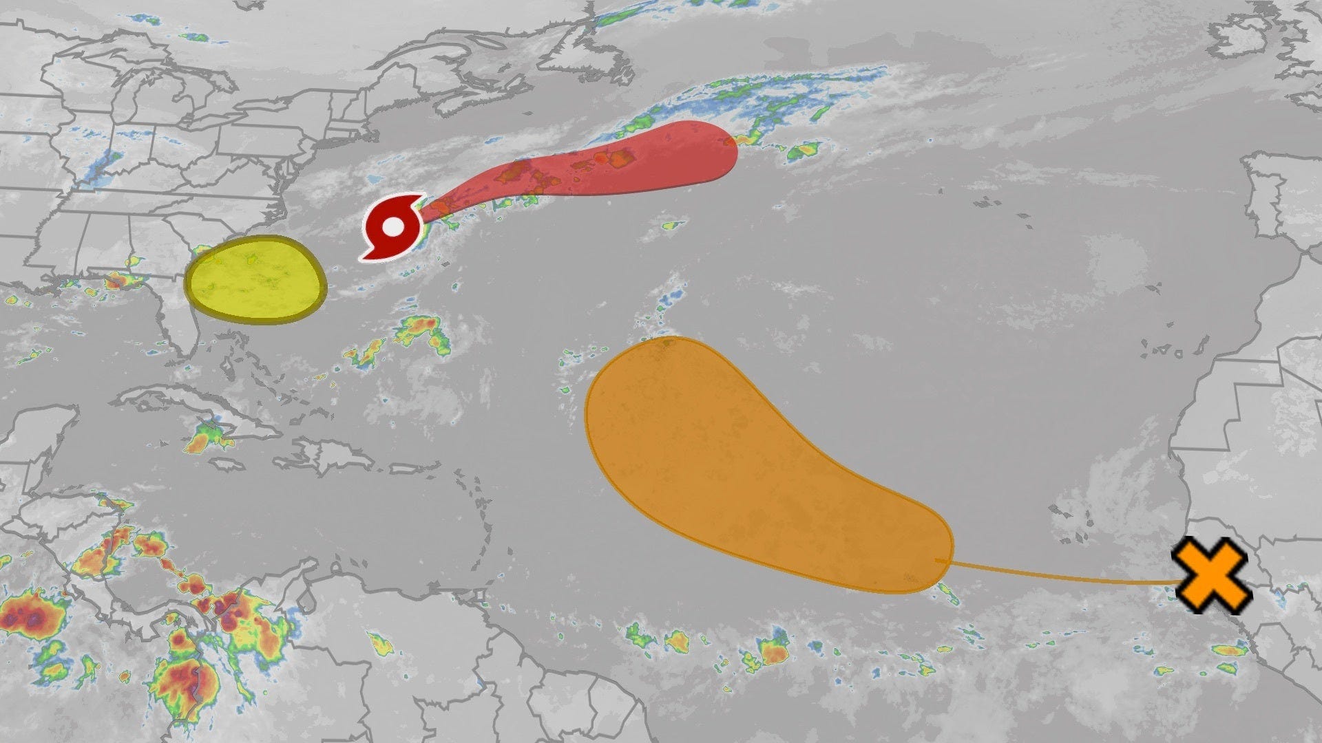
Tropical moisture coming from a disturbance several hundred miles off the coast was causing showers and thunderstorms, which could pose an even greater risk to the coastal Southeast if it forms into a cyclone, hurricane forecasters said. As of mid-week, it had a 10% chance of development within 48 hours and a 40% chance within a week.
Since Aug. 4, a zone from southwestern Georgia through central North Carolina has already received 2 to 6 inches of rain since the start of the week, according to AccuWeather. An additional 2 to 4 inches could fall Aug. 6, the outlet said, risking flooding from already swollen rivers and streams.
"Persistently heavy rain could severely disrupt transportation and logistics networks. Flooded underpasses, debris-blocked roads and washed-out rural routes are likely, particularly where drainage is poor and rainbands stall," AccuWeather said in a news release.
Metro areas at risk through the evening include Raleigh, Greensboro and Fayetteville, North Carolina; and Florence and Myrtle Beach, South Carolina, AccuWeather reported.
Rainy, stormy weather across much of US
Forecasters said several regions across the country are in the path of storms and showers this week, including a region at risk for severe thunderstorms, large hail and damaging winds in the Northern and Central Plains and upper Mississippi Valley later in the week. There is also a chance of tornadoes, the national Weather Service said.
By the afternoon of Aug. 8, the Storm Prediction Center said a cluster of strong to severe thunderstorms would move across the Dakotas and into Minnesota with hail over 2 inches in diameter.
More showers and severe thunderstorms are expected across a large stretch of the country from the Great Lakes region through the Northeast and Mid-Atlantic and southward to the Gulf Coast on Aug. 7.
Dangerous heat, fire weather in the West
Extreme heat is settling in the Southwest, with over 7 million people in Southern California and Arizona under extreme heat warnings on Aug. 6. Heat advisories also included parts of New Mexico and Texas, the weather service said. Heat-related illnesses are a big threat as temperatures reach highs in the mid-110s for the rest of the week.
"As temperatures rise, limit outdoor activity, stay hydrated, and ensure access to air-conditioning and other cooling areas," the weather service said.
Parts of Nevada, Utah, Colorado, Wyoming and Idaho are all under red flag warnings as conditions are favorable for fires to break out with low humidity and wind, the weather service said. Any new fire could spread rapidly.