Friday's forecast: Summer heat, storms for many
Another warm, humid day is on tap for the Friday of Labor Day weekend for most of the country.
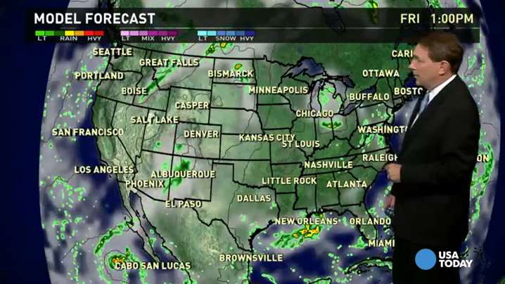
Central U.S.: Some severe storms are possible in the northern Plains on Friday, mainly in portions of North Dakota and Minnesota. Searing heat will be the story in the central and soutnern Plains, with highs well into the 90s.
East: Summerlike heat and afternoon thunderstorms will be seen in much of the East. The Great Lakes, Mid-Atlantic, Florida and Gulf Coast are where the storms are most likely.
West: The one chilly spot Friday will again be the Northwest, where a cool rain and temperatures in the 60s are forecast. Afternoon showers and storms will again fire up in the central and southern Rockies.
YOUR TAKE: Share your weather photos
Weather history for Sept. 4: In 1970, heavy rains led to devastating and deadly flash floods in Arizona. A state-record of 11.4 inches of rain fell in 24 hours. 23 people died in one of the state's worst natural disasters on record.
In 1988, Stampede Pass, Wash., soared to 91 degrees, its all-time record high temperature.